Sacramento’s first protected bikeways (also sometimes called protected bike lanes, cycle tracks or separated bikeways) are being installed on three downtown streets and we’re hearing a lot of questions. This is the second of several blog posts where we’ll explain more about this kind of bike infrastructure.
1. They’re the first ones in Sacramento, but not in the region.
There’s a protected bikeway in Davis on J Street near Drexel Drive, and in West Sacramento on Linden Road, west of Jefferson Blvd. More are planned for Sacramento and also in Rancho Cordova.
As of 2016 there were 292 streets with protected bikeways in 82 North American cities. Sacramento is actually somewhat late to this particular party.
Read more here about the inventory of protected bikeways in North America.
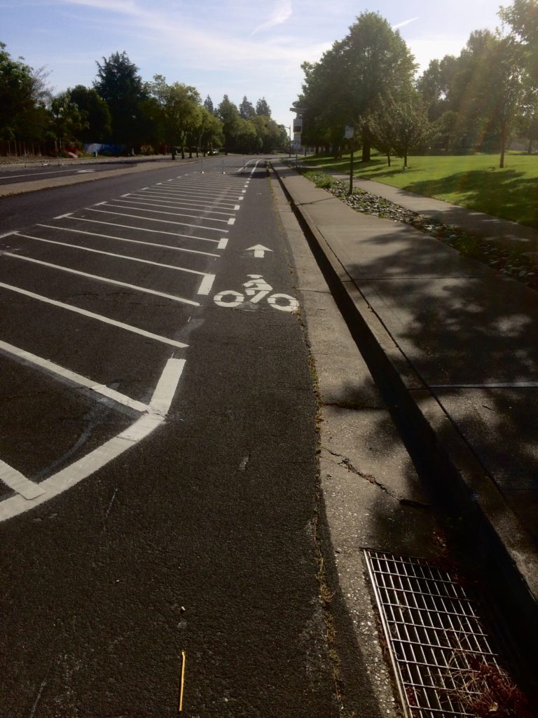
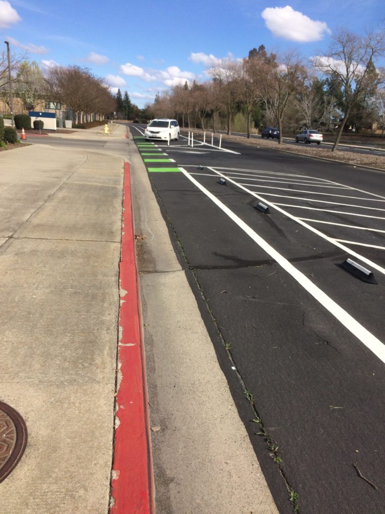
2. The location on the left side of P and Q streets is one of the standard designs.
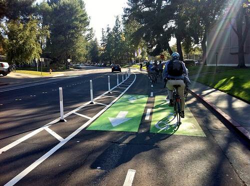
Two features make a protected bikeway “protected”: a painted buffer at least 2 to 3 feet wide and a vertical element such as a flexible bollard, median, planter or a row of parked cars.
Protected bikeways are almost always placed against the curb. They can be one-way or two-way and can be placed on the right side or left side.
Sacramento’s new protected bikeways were designed according to Caltrans standards, which provide for flexibility to accommodate the characteristics of a specific street – for example, not all streets are the same width. The City of Sacramento located the bikeway on the left side of P Street because of the high number of public transit and commuter buses with loading areas on the right side of the street, especially west of 14th Street. While there are design options for protected bikeways that wrap behind bus stops, they only work where there is enough road width. P Street wasn’t wide enough and widening it wasn’t an option.
On Q Street the left-hand bikeway keeps bike traffic separate from the large volume of eastbound vehicle traffic that turns right onto 15th St.
The protected bikeway on 10th Street between L and I streets is located on the right side of the street.
Read more here about the various kinds of protected bikeways.
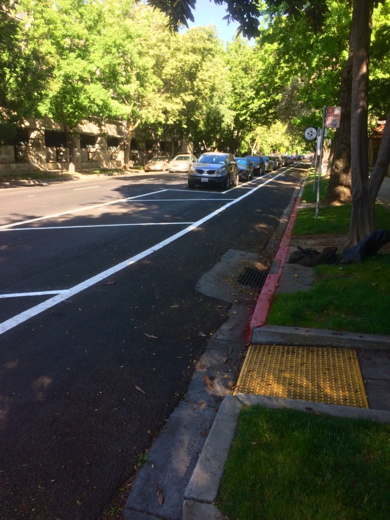
3. The new parking lanes provide for increased visibility at intersections.
The project increases sight distances at streets that cross P and Q streets by removing one or more spaces from near each intersection. The shorter parking lanes on P and Q make people on bikes (as well as pedestrians) more visible to drivers.
For drivers waiting to cross north at P Street or south at Q Street, the approaching bike traffic is now visible for the entire length of the block – much more visible than where the bike lane is placed on the outside of the parking lane.
This design happens to be the oldest kind installed in the U.S. The first two protected bikeways in the U.S. were installed on 8th Ave. and 9th Ave. in Manhattan. Both are on the left side of one-way streets and buffered by parked cars.

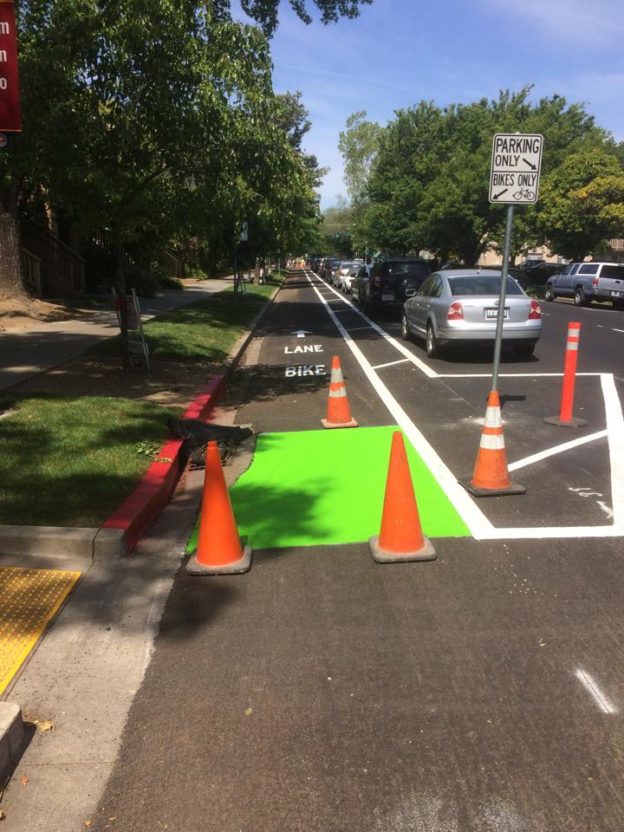
4. Green paint will highlight specific points of conflict.
Where the protected bike lanes cross entrances to 8 parking lots, garages and alleys on P and 10th streets, those entrances will be painted bright green to signal to drivers and people on bikes to use extra caution, as recommended in Federal Highway Administration standards. You can already see green paint used this way on Carlson Drive at H and J streets.
Continuous green bike lanes are generally no longer installed, due to high maintenance costs.
5. The new bikeways will improve safety but won’t completely eliminate hazards.
Creating more separation between bikes and cars on busy streets reduces the potential for conflicts. That’s what protected bikeways are designed for. New York City’s protected bike lane on 9th Avenue led to a 56 percent reduction in injuries to all street users, including a 57 percent reduction in injuries to people on bikes and a 29 percent reduction in injuries to people walking, as well as an 84 percent reduction in sidewalk riding.
A traffic lane on each street has been removed on 10th, P and Q streets to accommodate the new bikeways. This so-called “road diet” slightly increases vehicle congestion, which has the effect of reducing speeds. But it doesn’t completely eliminate potential conflicts at an intersection with a two-way stop (i.e., for cross traffic only) or at alleys.
For example, there are no stops for traffic heading west on P St. at 14th, 13th and 11th streets. Vehicles can freely turn left or right. Where cars turn left, they cross the left-side bike lane without having to stop. This hazard currently exists on all one-way, two-lane streets with a conventional bike lane on one or both sides and no controls at cross streets, including portions of 5th, 9th, 10th, 19th, 21st, G, H, N, P and Q.
Creating more four-way intersections with stop signs and traffic signals can help reduce this hazard, although that’s an expensive option – one 4-way traffic signal costs about $1M. And even then, these kinds of collisions also occur at intersections with 4-way traffic controls.
The protected bikeway project reduces this hazard two ways: the road diet helps calm traffic speeds, giving drivers and bicyclists more reaction time, including drivers making right or left turns, and the removal of parking spaces at the intersections makes bicyclists more visible to turning drivers.